Geographie
GEOGRAPHICAL LOCATION
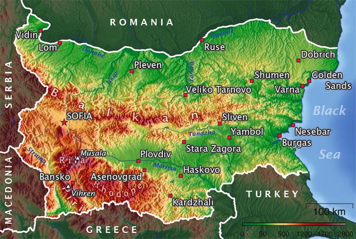
 Bulgaria is an Southeastern European country, situated in the east part of the Balkan Peninsula. Its territory spans on parts of the historical and geographical regions of Moesia, Thrace and Macedonia. Bulgaria''s whole eastern border is determined by the Black sea, to the south it shares borders with Turkey and Greece, to the west with Macedonia and Serbia and to the north with Romania, where natural border has been the Danube river. Its territory is 110 921 km2.
In physical and geographical aspect, Bulgaria is a transitional zone between the moderate and the subtropical (Mediterranean) physico-geographical zones. Its relief and transitional character of its climate determines the diversity of the local flora and fauna. This location has influenced the climate, the flora and the fauna.
The country''s population is about 7 606 000 people, which means, that Bulgaria is relatively underpopulated - around 70 people on a km2.
TERRAIN
The terrain of Bulgaria is mainly mountainous and includes many mountains, hilly regions, valleys and plains. The average altitude above sea level in Bulgaria is 470 m, with the highest point in the country being Musala Peak in Rila mountain, which is 2925 m high. If someone takes a look on the map of Bulgaria from north to the south, one can easily distinguish four geographical areas i.e. the Danube plain, Stara Planina mountain range, Thracian lowlands and Rilo-Rhodope massif.
Mountains
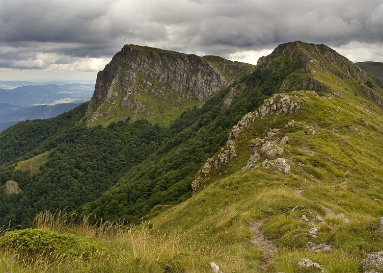
The highest mountains on the Balkan Peninsula are situated on the territory of Bulgaria. The mountain that gave the name to the whole peninsula is in Bulgaria too – the Balkan Mountains (Stara Planina). The Bulgarian Mountains are accessible all year round and provide unlimited opportunities for recreation, sport and tourism.
Plains
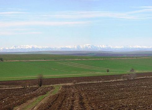
 Plains and lowlands in Bulgaria occupy the smaller part of its territory. They are situated to the north and to the south of the Balkan Mountains.
The Bulgarian Black Sea coast
 The Bulgarian Black Sea coast spans on the east part of Bulgaria. It is 378-km long, of which 200 km is the beach line covered with sand. The Balkan Mountain “sinks” into the Black Sea at Emine Cape dividing provisionally the shore line into south and north part. The South coast is famous for its wide and long beaches covered with finest sand as opposed to the north coast, which has more rocky terrain, but still can offer some first class beaches such as the St.St.Konstantin and Elena, Golden sands and Albena resorts. The region is an important centre of sea recreation and tourism. It is visited mainly in summer by Bulgarian, as well as by foreign tourists and is one of the main tourist destinations in Bulgaria. Some of the most famous Bulgarian Black sea resorts are Albena, Balchik, Dunite, Elenite, Golden Sands, Kiten, Nesebar, Obzor, Pomorie, Sveti Vlas, Sunny Beach, Sozopol, etc. Varna city is called the capital of the North Black Sea coast, and Burgas city - of the South Black Sea Coast.
RIVERS
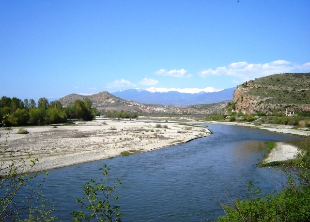
 Bulgarian rivers are quite short, with small catchment basins, which are not very deep. Rivers flow to the two sea basins - the Black Sea Basin and the Aegean Basin. About 2200 dam lakes are built for the adjustment of the river run-off. Danube River å is the largest Bulgarian River. It outlines the north border of Bulgaria and is the common border between Bulgaria and Romania for 470 km.
 Bulgaria is an Southeastern European country, situated in the east part of the Balkan Peninsula. Its territory spans on parts of the historical and geographical regions of Moesia, Thrace and Macedonia. Bulgaria''s whole eastern border is determined by the Black sea, to the south it shares borders with Turkey and Greece, to the west with Macedonia and Serbia and to the north with Romania, where natural border has been the Danube river. Its territory is 110 921 km2.
In physical and geographical aspect, Bulgaria is a transitional zone between the moderate and the subtropical (Mediterranean) physico-geographical zones. Its relief and transitional character of its climate determines the diversity of the local flora and fauna. This location has influenced the climate, the flora and the fauna.
The country''s population is about 7 606 000 people, which means, that Bulgaria is relatively underpopulated - around 70 people on a km2.
TERRAIN
The terrain of Bulgaria is mainly mountainous and includes many mountains, hilly regions, valleys and plains. The average altitude above sea level in Bulgaria is 470 m, with the highest point in the country being Musala Peak in Rila mountain, which is 2925 m high. If someone takes a look on the map of Bulgaria from north to the south, one can easily distinguish four geographical areas i.e. the Danube plain, Stara Planina mountain range, Thracian lowlands and Rilo-Rhodope massif.
Mountains
The highest mountains on the Balkan Peninsula are situated on the territory of Bulgaria. The mountain that gave the name to the whole peninsula is in Bulgaria too – the Balkan Mountains (Stara Planina). The Bulgarian Mountains are accessible all year round and provide unlimited opportunities for recreation, sport and tourism.
- The Balkan Mountains
 has a well-marked terrain and crosses the country from west to east dividing it into North and South Bulgaria. To the north of the mountains are located the lower areas of the Pre-Balkan, which make the transition to the Danube plain. In the south parallel to the Balkan Mountains lays the lower mountain chain Sredna Gora. The region of the Balkan Mountains is famous for its great natural phenomena. In the west part of the Balkan Mountains are situated the unique Rocks of Belogradchik that were included in the ranking for the new seven natural wonders of the world. 25 km to the northwest of Belogradchik is one of the biggest caves in Bulgaria - Magurata, famous for its unique cave drawings that were dated back to 3100 - 900 B.C. More...
Plains
 Plains and lowlands in Bulgaria occupy the smaller part of its territory. They are situated to the north and to the south of the Balkan Mountains.
- The Danube Plain occupies the north part of Bulgaria and spans from the Danube valley in north to the lowest hills of the Pre-Balkan. To the northeast in Dobrudja it has semi-steppe character. The Danube plain has great economic significance for Bulgaria because a big part of the plain is used for agriculture. Most popular agricultures grown here are corn, sunflower and soy. Some of the big regional centers in the country are here such as Pleven, Lovech, Razgrad, Shumen and Dobrich. More...
The Bulgarian Black Sea coast
 The Bulgarian Black Sea coast spans on the east part of Bulgaria. It is 378-km long, of which 200 km is the beach line covered with sand. The Balkan Mountain “sinks” into the Black Sea at Emine Cape dividing provisionally the shore line into south and north part. The South coast is famous for its wide and long beaches covered with finest sand as opposed to the north coast, which has more rocky terrain, but still can offer some first class beaches such as the St.St.Konstantin and Elena, Golden sands and Albena resorts. The region is an important centre of sea recreation and tourism. It is visited mainly in summer by Bulgarian, as well as by foreign tourists and is one of the main tourist destinations in Bulgaria. Some of the most famous Bulgarian Black sea resorts are Albena, Balchik, Dunite, Elenite, Golden Sands, Kiten, Nesebar, Obzor, Pomorie, Sveti Vlas, Sunny Beach, Sozopol, etc. Varna city is called the capital of the North Black Sea coast, and Burgas city - of the South Black Sea Coast.
RIVERS
 Bulgarian rivers are quite short, with small catchment basins, which are not very deep. Rivers flow to the two sea basins - the Black Sea Basin and the Aegean Basin. About 2200 dam lakes are built for the adjustment of the river run-off. Danube River å is the largest Bulgarian River. It outlines the north border of Bulgaria and is the common border between Bulgaria and Romania for 470 km.
- The Danube provides great opportunities for the development of water tourism. It is the biggest international waterway, which connects Bulgaria with the countries from West and East Europe. The river has great economic, cultural and historical significance for Bulgaria. Along the Bulgarian bank of the Danube river are situated the big cities Vidin, Ruse and Silistra. More...


